Go To Mount Kenya - The Best Guides To The Kenyan Mountains
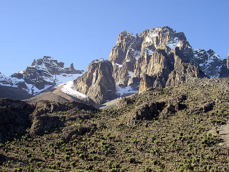
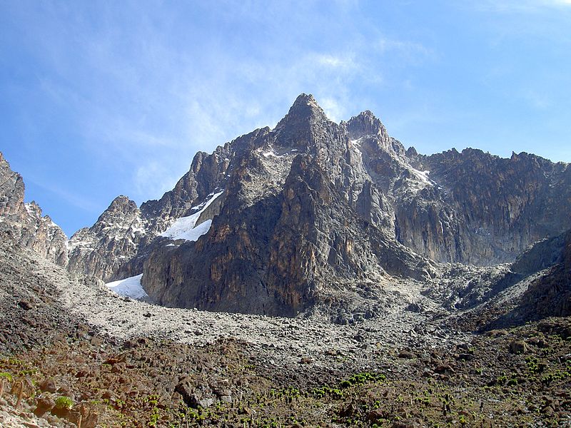
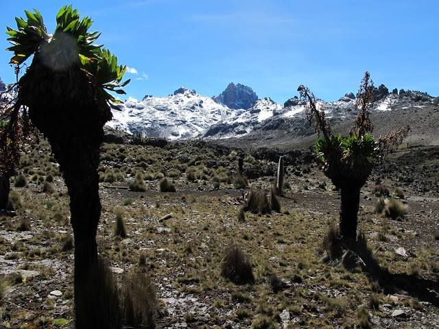
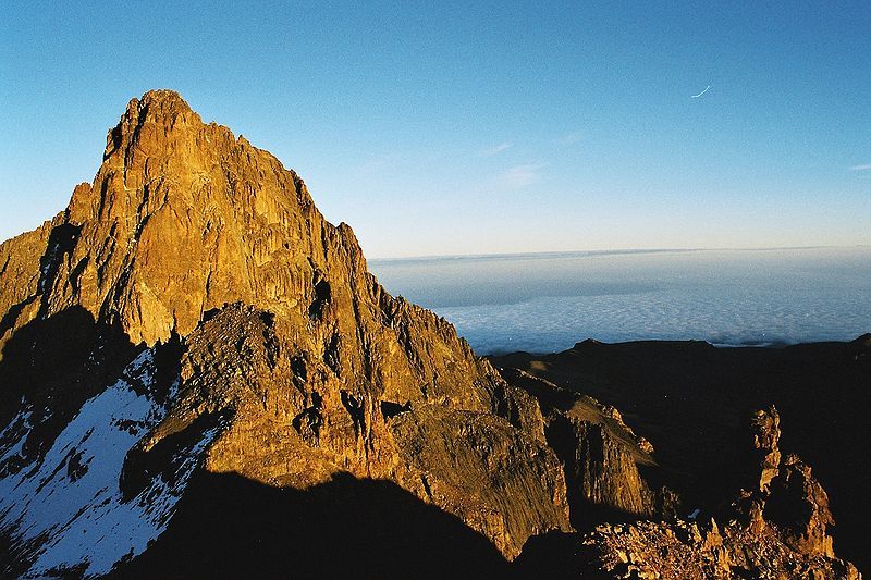
Two main peaks of Mount Kenya rise to a height of over 5000 meters, making Mount Kenya the highest mountain of Kenya and the second-highest in Africa, after Kilimanjaro. Mount Kenya is located in central part of the state, around 160 kilometres northeast of Nairobi. It was first climbed in 1899. Its highest duo summits are called Batian and Nelion. The mountain itself is full of many other individual peaks suitable for rock climbing. You can enter the Mount Kenya National Park either through the official gates or as a holder of Kenya Wildlife Service permission. It is possible to get to the top in just two days, but the pace of Africa's commands us differently. Slower, but with the maximum enjoyment.
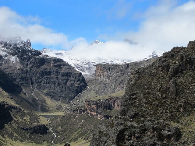
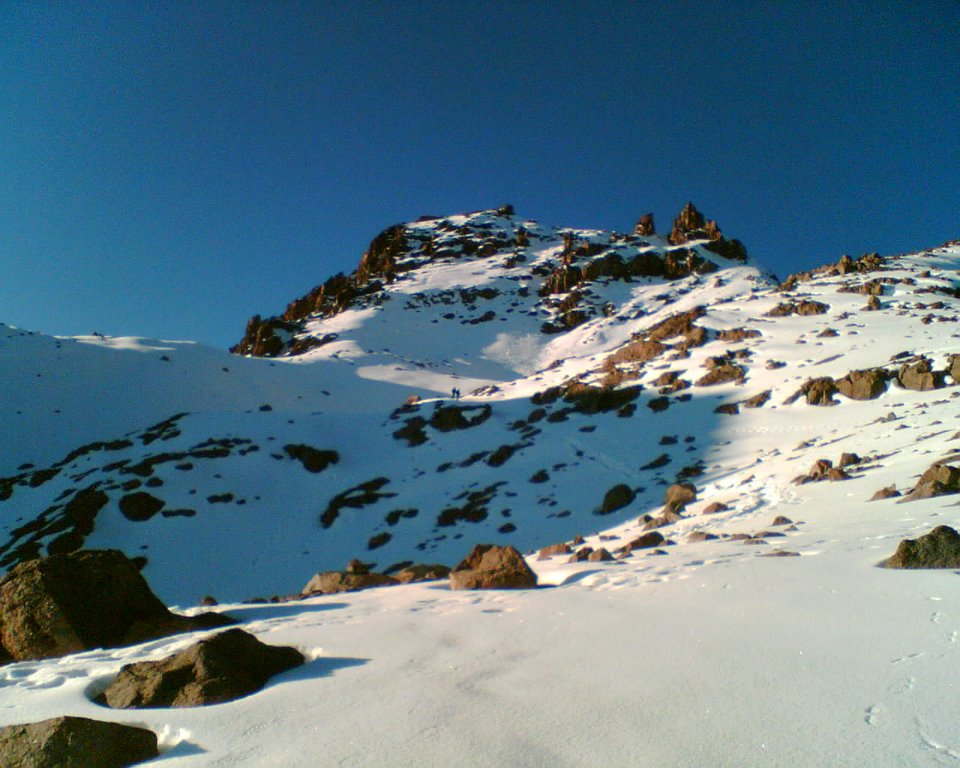
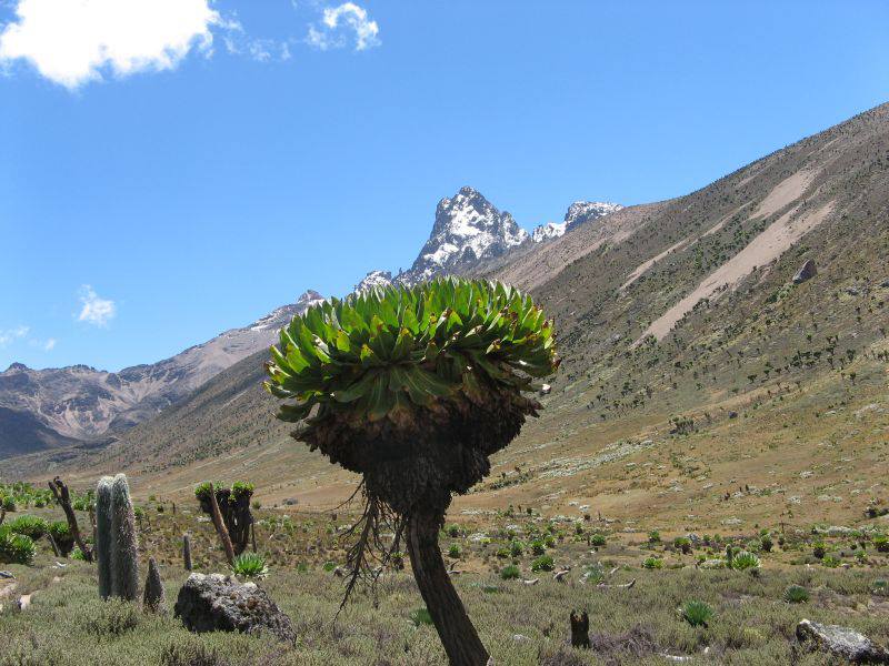
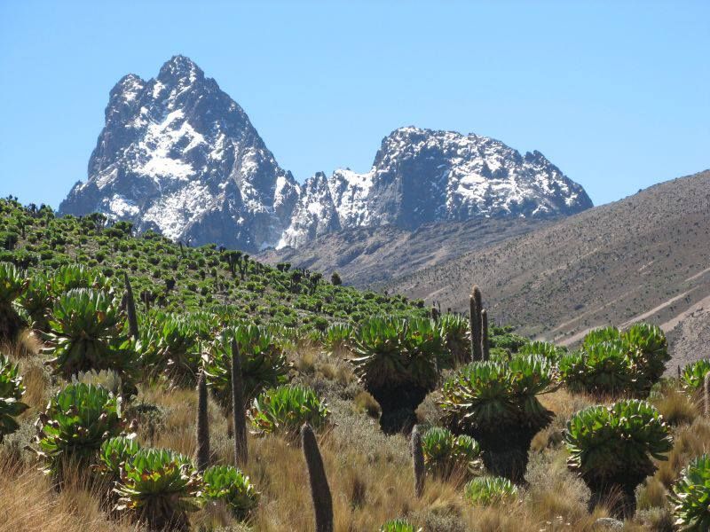
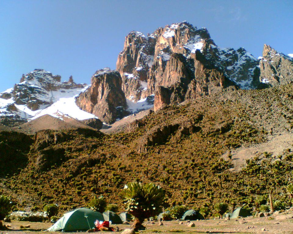
Kenya Wildlife Service (KWS) regulations require all visitors to register upon entrance to the mountain and sign out on departure. Hiking alone is prohibited. The elevation of your journey ranges from 2200 metres to 5200 metres and includes several distinct vegetation zones: mixed broad-leaf forest, gallery forest, bamboo, Giant Heath and Hagenia, moorland tussock grasses, Giant Senecio and Lobelia and, at the uppermost parts, left with just rock and ice. The peak area is formed from the hard core or plug of the volcano, the crater having long since been eroded away. It is exactly the volcano remnants that rise steeply on all sides some 450 m above the glaciers and scree slopes. There is excellent high-class rock and ice climbing to the twin summit peaks of Batian (5199 m) and Nelion (5188 m). The third highest peak is Pt. Lenana (4985 m), which can be reached by any fit and suitably equipped hiker. Although Mount Kenya can be climbed all year round, the highest rainfall occurs between March and May. Also, slightly less, between late October and mid December. No fires allowed and you have to take all litter with you.
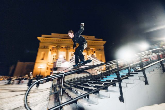
November 4, 2023 – Val Verzasca, Switzerland – The Verzasca Dam, an engineering marvel nestled in the picturesque Val Verzasca of Switzerland that stands 220 meters tall, became the stage for the climbing elite. Red Bull Dual Ascent, now in its
second edition, attracted 24 of the world's best…
Batian, 5199 meters - left, Nelion, 5188 meters - on the right.
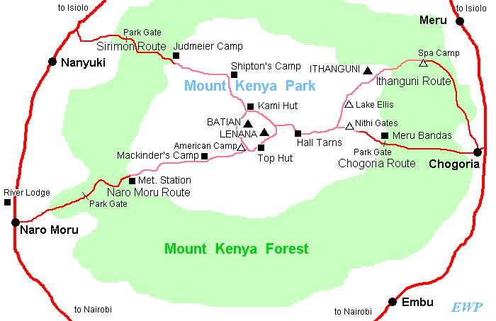
There are several different routes to climb Mount Kenya. Here the four main come:
Sirimon Route
The easiest and most scenic access to the Northern side of the central peaks, which include Batia, Nelion and Lenana. The track is 15 km from Nanyuki town heading towards Meru. This routes has a lot of advantages that makes it more favorable and comfortable. It lies on the northwestern side of Mt. Kenya, and generally escapes some rainfall, making it drier than other routes most time of the year. There are two permanent camps, the Old Moses at 3300 m and Shipton’s camp at 4200 meters. Water on the route is plentiful and you can always refill your bottles. You can get over the Equator both at Nanyuki and on your way to Old Moses Camp.
Chogoria Route
This route provides access to the peaks, from the eastern side of the mountain. The route begins from Chogoria town; about 96km from Embu and 64km from Meru. It is regarded as being the most beautiful route to the mountain. Ernest Carr, who made a vehicle track to the moorland, opened it in 1920s. It is, however, much longer route compared to others. Camping is possible at the road head and water is available from a stream that passes by. Mintos Hut (4,300m) is an excellently sited hut on the plateau overlooking Lake Michaelson 300m below. Spectacular views can be sighted at the Nithi George, by walking ten minutes south-east of the Mintos hut to the edge of the “Temple.” From Hall Tarn the trail continues to the Austria Hut (4,790m) via square Tarn and the Tooth Col, then round the head of the Hobley Valley. Alternatively Shipton’s Camp (4,200m) may be reached (3 hours), via Simba Col. Drop down towards lower Simba Tarn and turn left to Shipton’s Camp.
Naru Moru Route
This route to the Teleki Valley and is the shortest way to the peaks. It is with the highest density of hikers - owing to the fact that is the shortest way up, and most obvious trail. A steep marshy section known as the Vertical bog, is reached one hour from Met Station, this section is difficult and usually takes from one to two hours. After three to four hours from Met Station the path reaches the crest of the ridge overlooking Teleki Valley, lying at 4000m. The path then contours along the right hand side of the Teleki Valley, keeping high and then gradually descending to pass Naro Moru stream to Mackinder’s Camp (4,200m). From Met Station to Mackinder’s camp is app 5-6 hours of hiking. The Austrian hut can be reached in a further 4 hours walk and another 45 min you see the Lenana point (4985m).
Burguret route
The route starts from Mountain Rock Hotel, and goes through the forest past Gathiuru Forest Station to an indistinct road head at the end of the plantation area – 2,500m. The trail continues from here to elephant camp 2,600m, cuts through tropical rainforest till it gets to the more open Hagenia-Hypericum Zone at 2860m and eventually to the Heath Zone from where you can now clearly see the peaks. Further on after the castle there is a good campsite „kampi ya farasi“(for overnight stay). From here the trail swings left and climbs steeply out of the valley. The ridge bears right again, and a walk over rocky ground brings you round the hill. The path then swings to the left via the Hausberg Col and Oblong Tarn to Mackinder’s valley and descends down to Shipton’s Camp at 4,200 meters.
Summit Circuit of the main Peaks
Beginning from Shipton’s Camp you ascend directly to Kami Hut, follow the sandy scree to Hausberg Col and drop steeply to Oblong and Hausberg Tarn for a short rest. Then the path leads straight on between the two tarns to reach the foot of a scree slope that climbs steeply up a to reach a col with Nanyuki tarn base. The route trends left and downwards from the col passing below Arthurs seat, trends to reach Nanyuki Tarn, passes to the left of the tarn, to climb a short rocky section, then cross a small col to reach Hut Tarn, turning right to reach Two Tarn Hut (4,490m). From here the path continues along the right side of the tarn, climbs a bolder to reach a scree overlooking Teleki Valley then drops through a steep scree slope to reach Mackinder camp (4,200m). From Mackinder’s trend northwards to meet a path coming from American Camp, the path to Austrian Hut can be seen snaking up the large scree slope on the opposite side of the valley, follow this clearly cairned path around the head of a valley. Cross a boulder scree and a large buttress, trend steeply upwards to reach Tooth Col, from this col it is possible to see down into Georges Valley and Hall Tarns. The path then drops down to square Tarn, continues to follow cairns trending left and down towards Simba Tarn, drop steeply down towards the lower Simba Tarn the cut across the to the shiptons camp. Hiking time to complete the circuit is eleven hours. It is advisable to split the trip into two by spending a night a t the Mackinder’s camp on the Teleki Valley (4,200m).
We decided to introduce you probably the finest team of indigenous guides, who know well how not to hurry in Africa´s Mountains. Their company is one of the leading personal guiding companies in Kenya. They are set up to provide you with a very personal service. With them, you will be dealing directly with the people who benefit directly from your visit. You won’t get closer to the environment than that. The team of GoToMountKenya was established in 1994. Each assignment is a project in its own right – you or your team, their team and the mountain. The size of their team is directly related to the number on your team. That way they ensure the correct level of attention to you and your safety. They have worked together for many years and know and trust each other implicitly. Hopefully, you will know a great deal more about them when you leave Kenya. Adrex.com recommends GoToMountKenya services.
Contacts: GoToMountKenya, 1st floor Gilfillan House Kenyatta avenue, next to I&M building, Room No: 101, Nairobi, Kenya. Tel. +254 518010691 For more information go to: www.gotomountkenya.com
Source: GoToMountKenya website Thanks to Evans Mwangi. All images are property of GoToMountKenya. Video: Youtube Text: Thomas
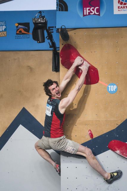
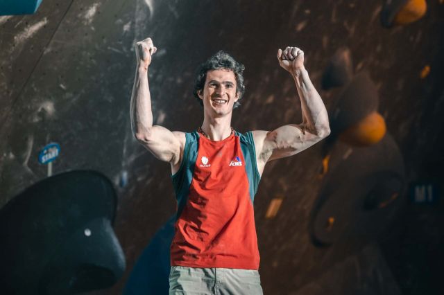
Adam Ondra dominated the bouldering scene again and won a gold medal in the second World Cup competition in Salt Lake City. He took second place in the qualification and proceeded to the finals from the same position. This time, he was surprised by the victory and admits that a little luck was…
Adam Ondra completed today's finals in Meiringen, Switzerland, and won a gold medal in the first competition of this year's World Cup. He kept first place in bouldering continuously from the qualification until the very exciting finals. He was satisfied with his excellent form and appreciated a…