Mount Kinabalu – The highest point on the island of Borneo
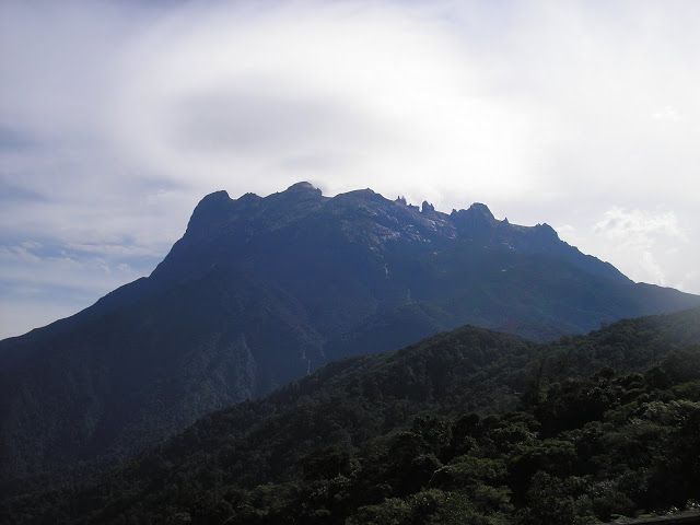
Mount Kinabalu (Malay: Gunung Kinabalu) is a prominent mountain on the island of Borneo in Southeast Asia. It is located in the East Malaysian state of Sabah and is protected as Kinabalu National Park, a World Heritage Site. Kinabalu is the highest peak in Borneo's Crocker Range and is the highest mountain in the Malay Archipelago. Mount Kinabalu is also the 20th most prominent mountain in the world by topographic prominence.
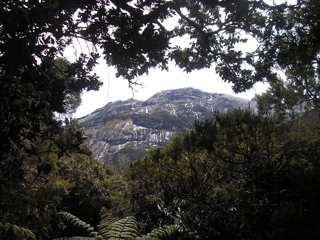
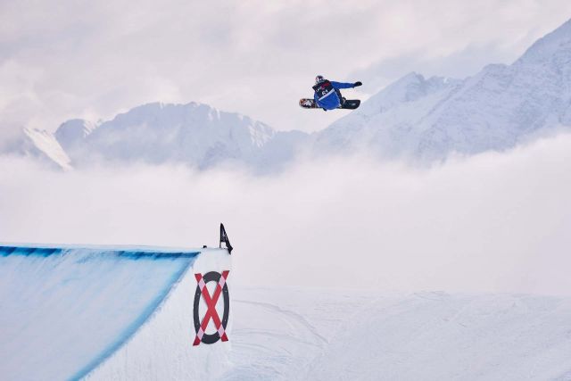
The highest point on the island of Borneo, Kinabalu is probably the most popular hike in Southeast Asia. It is a truly stunning mountain – crowned with various glistening granite peaks and spires. Besides the great beauty of the mountain itself, its popularity is also due to its height, its accessibility from nearby Kota Kinabalu and also because it is well-publicised and information is far more readily available online than for Indonesian peaks of a similar height. Most people climb to the peak for dawn on the second day, and at 4,095m it gets very cold so remember to take lots of warm clothing.
Sadly, there are a number of administrative hurdles which need to be dealt with. First and foremost, the mountain is ‘owned’ by Sutera Sanctuary Lodges, a luxury holiday accommodation corporation. In conjunction with the National Park authority, Sutera Sanctuary Lodges has a monopoly on access to the mountain. No camping is allowed and you must book ahead – several months ahead – to reserve your place as part of a rather expensive ‘package’.
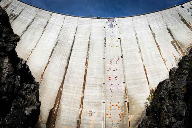
November 4, 2023 – Val Verzasca, Switzerland – The Verzasca Dam, an engineering marvel nestled in the picturesque Val Verzasca of Switzerland that stands 220 meters tall, became the stage for the climbing elite. Red Bull Dual Ascent, now in its
second edition, attracted 24 of the world's best…
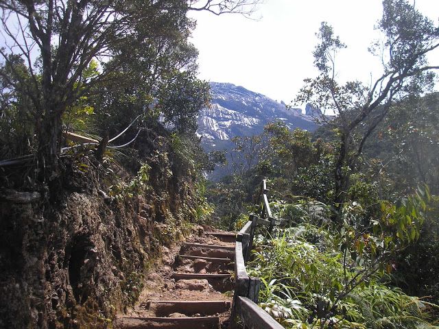
After you’ve sorted out the paperwork and donned your identification card, collect your lunch from yet another building and hop into the transport to travel the 4km to Timpohon Gate (1,777m). This is the true starting point of the hike. There is a sign here detailing the fastest ascents of Kinabalu – the current fastest ascent/descent is an unbelievable 2 hours and 33 minutes by Marco de Gasperi (in the Climbathon 2010). For most mere mortals, it takes at least 7 hours up and 5 hours down – 4 hours to reach Laban Rata, a further 3 from Laban Rata to the summit the next morning, 2 back down to Laban Rata and 3 back down to Timpohon Gate. The authorities request hikers start no later than 10.30am so that you are up at Laban Rata in good time for an early evening meal and some sleep.
Laban Rata is a great place to take it easy and prepare for your ascent the following morning. It’s also at a perfect elevation to get used to the lower level of oxygen in the air in time for your summit attempt the next day. Once you’ve registered and found your bed for the night make sure to try the local coffee and send a postcard home! The hot water and heating was broken in July 2011, but the hot buffet food is fantastic and the beds are very comfortable.
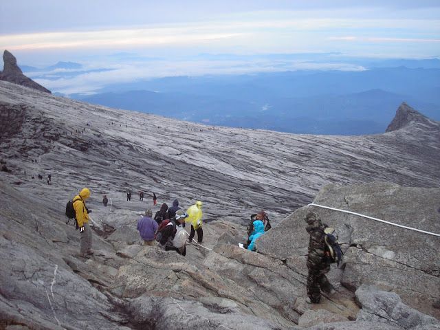
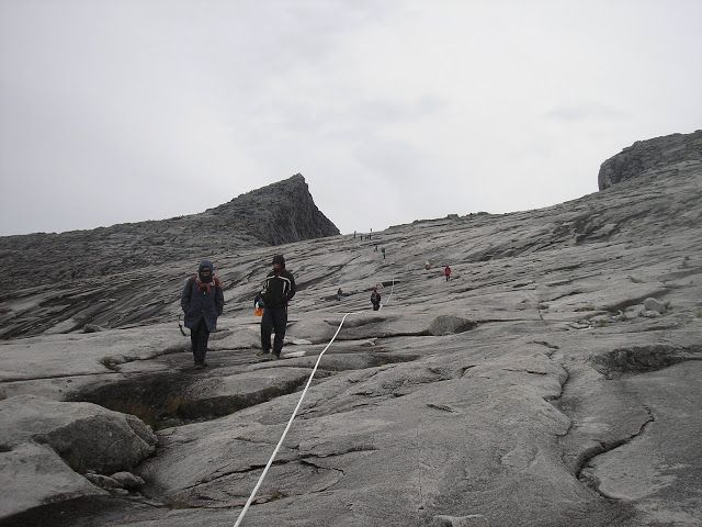
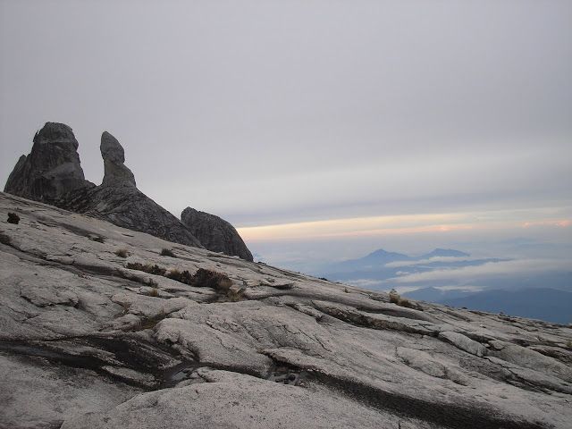
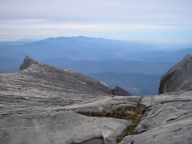
Breakfast is served from 2-3.30am and most hikers start the ascent to Low’s Peak at around 3am. The problem with this is that bottlenecks form and you may well find yourself waiting whilst the hundred hikers infront of you queue up on the narrow wooden steps up the mountainside. The climb itself gets really interesting when you get onto the granite itself. Ropes lead the way up and over huge granite slabs of the Panar Laban rock face. Do be careful here as you pull yourself up the rock – there are some sections where a fall would cause quite serious injury. Once past Sayat-Sayat hut and checkpoint and up onto the vast granite plateau near the summit the hiking is really enjoyable – simply following a thick white rope across the bare rock.
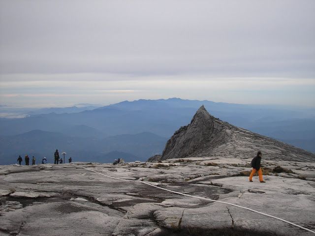
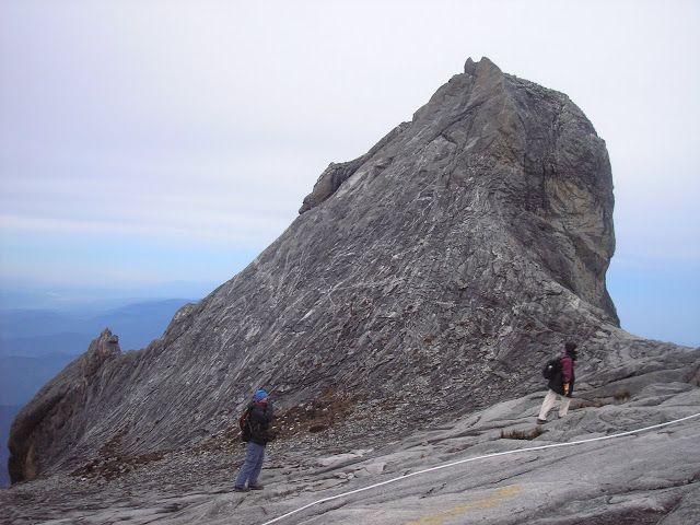
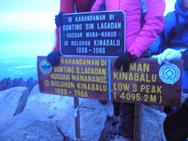
If you left Laban Rata at 3am, you should be at the very top of Borneo before 6am. It’s a crowded little place and care must be taken not to fall over the cliff edge! You will really appreciate your warm clothes, hat and gloves here just as the sun begins to rise over Sabah. If you’re lucky with the weather, as it gets light, you can admire all the other peaks on Kinabalu, some of which are just a few metres less than Low’s Peak. Ask your guide to point out Victoria’s Peak, St John’s Peak, South Peak, Ugly Sister Peak and Donkey’s Ears Peak to you. Despite being the highest, Low’s Peak itself is perhaps the least interesting in terms of shape. For hikers who don’t like using ropes this is a blessing because some of the other peaks look totally impenetrable! Low’s Peak is named after Sir Hugh Low, a British Colonial Secretary, who climbed the mountain in 1851. It must have been very tough to just get to within striking distance of the peak back then when the base of the mountain was surrounded by dense jungle.
How to get there:
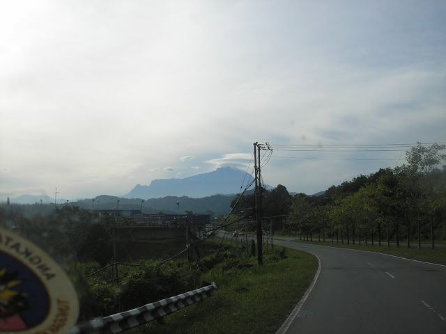
The nearest city is Kota Kinabalu and there are direct flights from Jakarta 3 times a week. KK is 2 hours drive from the National Park entrance. The cheapest way to get there is to take a minibus headed for Ranau (RM20) or share a taxi with others.
Permits:
An absolute nightmare! You need: an entrance ticket, climbing permit, guide, booked accommodation, transport to/from Timpohon Gate. As usual there is the racist policy of charging non-Malaysians a higher rate for most, if not all, of these.
Source : www.gunungbagging.com , Thanks very much to Daniel Quinn . Photos: Daniel Quinn
Adam Ondra dominated the bouldering scene again and won a gold medal in the second World Cup competition in Salt Lake City. He took second place in the qualification and proceeded to the finals from the same position. This time, he was surprised by the victory and admits that a little luck was…
Adam Ondra completed today's finals in Meiringen, Switzerland, and won a gold medal in the first competition of this year's World Cup. He kept first place in bouldering continuously from the qualification until the very exciting finals. He was satisfied with his excellent form and appreciated a…