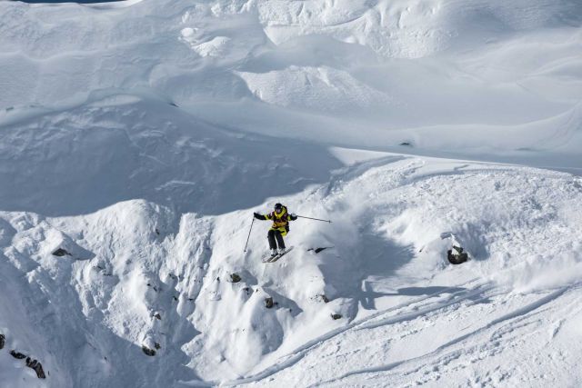
Coroico Death Road Biking - Downhill the World´s Most Dangerous Road, Bolivia
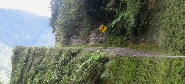
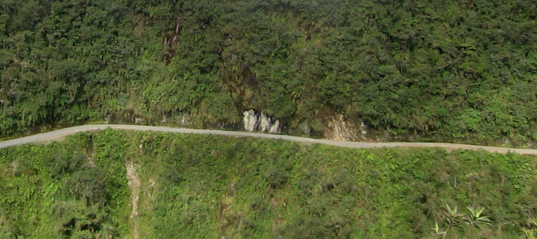
Coroico is considered the most dangerous road around the world. It is well-known as the road of death because of the extreme danger of falling into the abyss while driving it. The path, marked by crosses on many spots, begins only few miles northeast of the city of La Paz and descends towards the town of Coroico. Coroico (Yungas Road) is a soil road that offers and incredible sight while going down carefully, passing by the rivers, waterfalls, and the flora and fauna of this place.
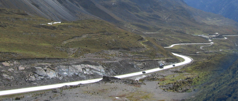
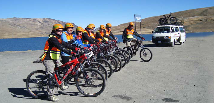
Mountain biking enthusiasts in particular have made Coroico Road a favourite destination for a calm downhill biking since there are over 40 miles of continuous downhill riding with just one short uphill part. The best option is to take transport from La Paz (located in a altitude of 3600 m) and continue northeast by Ruta Nacional 3. You have to head towards the foot of the Andean mountain range to the so called "cumbre"(summit) which is at 4700 m (15420 feet). During the short journey either by car or minibus you can watch dessert flora and fauna of the high plateau and snowy mountains of the Royal mountain range where the temperature reaches only from 0 to 5 degrees.
The Internet is full of tips for the guaranteed best “stuff”. However, the choice is always subjective or “to order”. That's why we reached out to various bikers to balance their subjective choices with a variety of perspectives. Young racer, a “dad” with a cycling background, a hobby rider, a…
While being taken out and above the city of La Paz, your downhill biking venture can start on asphalted road towards Unduavi town, in a very frigid climate. In this place you have to buy entrance tickets for the circuit which cost 30.00 Bolivians per person, it is a symbolic payment to support Death Road indigenous communities for their development. But if you are full of expectations, you have to travel further.
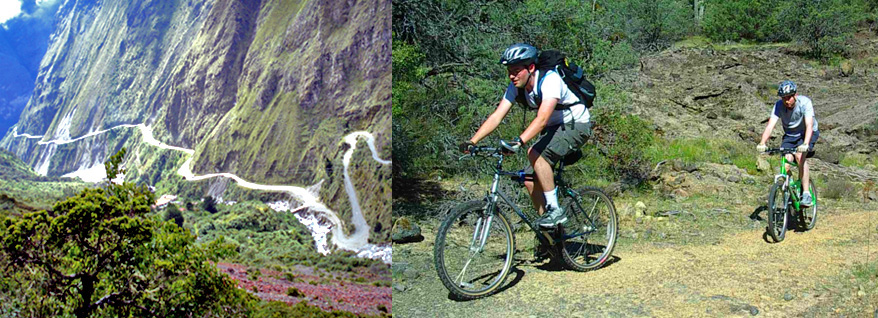
The second option is to continue until the soil road at Cotapata sub-tropical town, in a altitude of 2700 m, where the asphalted road ends and the onset of Bolivian forest begins. Cotapata National Park (Parque Nacional y Área Natural de Manejo Integrado Cotapata) is a protected area in the Yungas of La Paz Department. From Cotapata you first descend some 5 km to the point that you can find exactly marked in Adrex.com "Locations" section. Located in the middle of a long horseshoe-shaped curve, TURN RIGHT !, away from Road 3. This is where the true adventure begins. This is the start of NORTH YUNGAS ROAD. All the way down from here offers unrivalled Andean views and one of the greatest biking trails worldwide. Continue by this most exciting part of the track until arrival at Yolosa town located at 1200 m (3940 feet). Expect a completely different (hot) climate here.
The return to La Paz city is again by car or bus transport service along the newly built two-way highway called Cotapata Santa Barbara. Even for the South American standards, this one is very safe :-)
The Yungas Road is also known as Grove's Road, Coroico Road, Camino de las Yungas, Road of Fate or Death Road is 62 kilometers (38 miles) long.
Jenaro Yupanqui
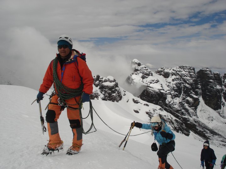
Adrex.com recommends services of Jenaro Yupanqui as one of the most experienced guides in the area. He was born in Pinaya (3800 m), region located not far away from the top of the base camp of the magestic snow covered Illimani (6462 m). He dedicates most of his life to taking people to climb, hike and ride different ice and rock mountains throughout the Cordillera Real, Cordillera Occidental and Cordillera de Apolobamba. He is an International Mountain guide UIAGM. Lic: YUPJ 010. He works as a leading guide for Elma Tours company in La Paz. You can follow Jenaro both to the mountains and bike trails.
Contacts: ELMA TOURS, Calle Sagarnaga Nº334 Galeria Alem, La Paz, Bolivia Tel. 591-2-2456823 Fax. 591-2-2312856 For more information go to: www.bikingbolivia.com
Source: Elma Tours website Thanks to Jenaro Yupanqui. All images are property of Elma Tours. Video: Youtube Text: Thomas
The Challenge gives participants the opportunity to bring home a little piece of Ötztaler. With its 28.7 kilometers and 1759 meters of altitude, the Timmelsjoch, the legendary finale of the classic bike marathon, also serves as the perfect mountain race course for the ROUVY Race on December 04, 2021…
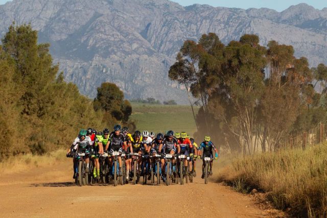
The Cape Epic 2021 returns after an absence of 32 months to the beautiful and iconic Table Mountain in Cape Town (RSA). The Absa Cape Epic is the world’s premier mountain bike stage race. This year’s route takes amateur and professional mountain bikers from around the world through 619km of unspoilt…